Borders
Sketching New Mexico's Counties
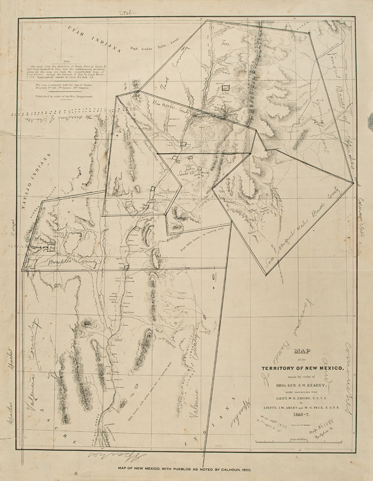
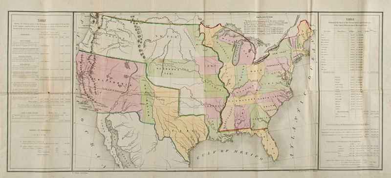
Emory, who eventually achieved the rank of major in the Corps of Topographical Engineers, mapped the Greater Southwest from 1844 well into the civil War, including the Mexican-American boundary and the Gadsden Purchase in 1848-1855. On this annotated copy of his map of New Mexico, he added hand-written boundaries. This information proved useful in the Mexican-American War and helped to establish New Mexico's future territorial boundaries.
W.H. Emory, Map of hte Territory of New Mexico (annotated). Lithograph, Washington, DC: B. Graham, 1847. Fray Angélico Chávez History Library NMHM, Map Collection 78.9 1846-47
A North-American Perspective
A Disturnell map was used during boundary negotiations by U.S. American and Mexican diplomats leading to the Treaty of Guadalupe Hidalgo (1848) at the end of the Mexican-American War. It was accepted as "authoritative" not because it was absolutely accurate, but because it was in general use in the United States and Mexico. Consequently, the imperfect settlement based on it - because it placed El Paso thirty-four miles north and one hundred miles east of its true location - precipitated the corrective Gadsden Purchase in 1854.
John Disturnell, Mapa de los Estados Unidos de Méjico.... Lithograph, New York: J. Disturnell, 1847. Courtesy Private Collection, Santa Fe [Copies of the Disturnell Map can also be viewed at the Chavez History Library]
A Map of Manifest Destiny
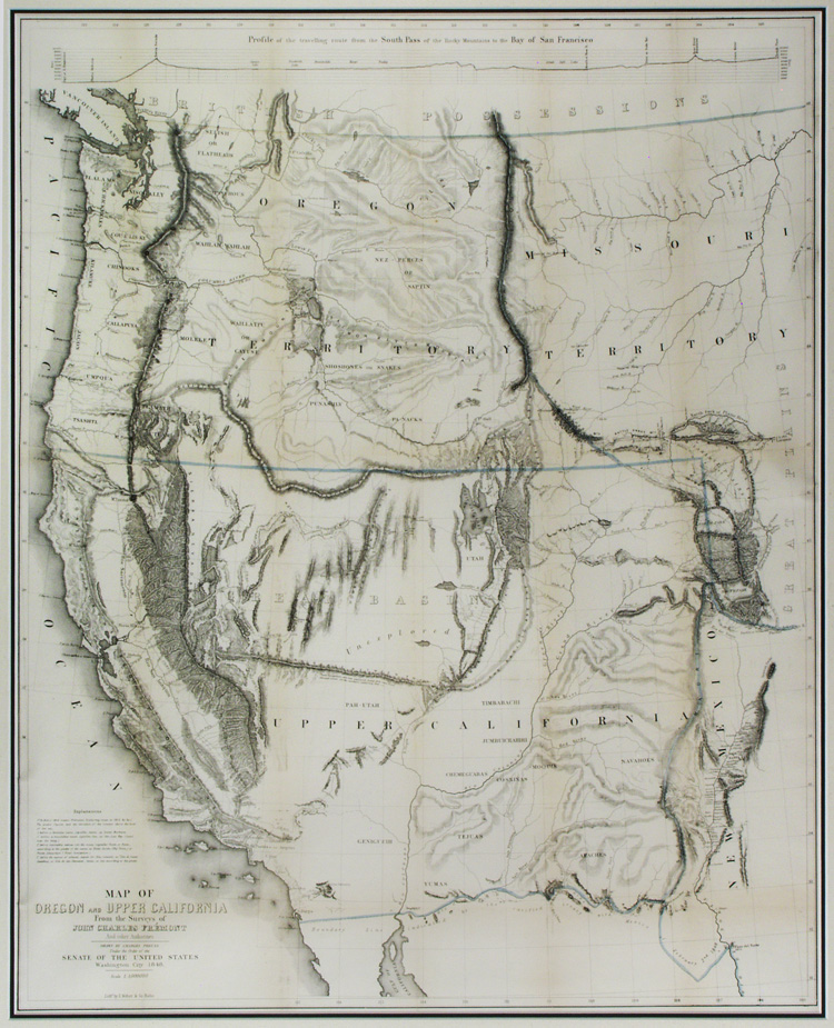
This seminal map, based on Frémont's explorations and other current reliable information and beautifully rendered by Preuss, is an illustration of American expansionism that fueled the policy of Manifest Destiny. Both men were in the Corps of Topographical Engineers. The map filled in many previously empty spaces and offered an accurate picture of the now-American West, including New Mexico on the far right, at the end of the Mexican-American War.
John Charles Frémont/Charles Preuss, Map of Oregon and Upper California from the Surveys of John Charles Frémont and Other Authorities. Lithograph, Baltimore: E. Weber and Co., Printers, 1848. Courtesy Mike and Debbie Houx, Albuquerque
The International Continent
This chromolithograph map drawn by Gilman, a draftsman for the publisher Duval, depicts the American West after the acquisition of the Mexican Cession. The New Mexican lands east of the Rio Grande still are erroneously shown as part of Texas as it defined itself as a republic after its independence from Mexico in 1836. Texas would maintain claims to areas of New Mexico until statehood in 1912.
E. Gilman, Map of the United States with Western Territories. Lithograph, Philadelphia: P.S. Duval [1851]. Fray Angélico Chávez History Library NMHM, Map Collection 78 E 1851
The Original Players in North America
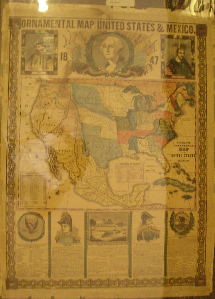
This colorful broadside map received wide distribution at the outset of the Mexican-American War. It evoked American patriotism and expansionism and explained American territorial aspirations in the entire Greater Southwest, along with issues surrounding the future border beween Mexico and the United States. [Better image will be uploaded as soon as available]
Ornamental Map of the United States and Mexico. Lithograph, New York: H. Phelps, 1846. Fray Angélico Chávez History Library NMHM, Map Collection 73.0 1847
New Mexico's Border Alignments
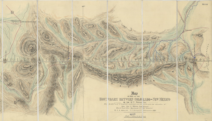
While the southern boundary of New Mexico was determined by the surveys connected with the Treaty of Guadalupe Hidalgo and the subsequent Gadsden Purchase, the other borders of the territory and future state were surveyed later. this elegant folding map depicts the outcome of the Daling 1868 U.S. government survey of the part of the 37th Parallel that became the boundary between the New Mexico and Colorado territories.
E.N. Darling, Map of Part of the boundary between Colorado and New Mexico on the 37th Parallel. Lithograph, London: Witherby and Co., 1868. Fray Angélico Chávez History Library NMHM, Map Collection 78.9 F 1868